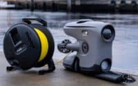
Top 20 Uses of Air Drones in Maritime Shipping: Enhancing Efficiency, Safety, and Innovation
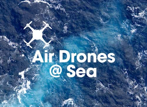
In the ever-evolving landscape of maritime shipping, air drones have emerged as game-changers, revolutionizing traditional practices with their versatile applications and cutting-edge technology. These unmanned aerial vehicles (UAVs) are no longer mere novelties but essential tools that enhance efficiency, safety, and environmental stewardship across the industry. From conducting detailed inspections and monitoring environmental conditions to supporting search and rescue operations, air drones offer a bird’s-eye view and real-time data that shipowners and operators can leverage for a wide range of critical functions. As the maritime sector continues to navigate the complexities of modern logistics and compliance, the strategic deployment of air drones is proving indispensable, heralding a new era of innovation and operational excellence.
* Please send feedback/suggestions to editor @ shipuniverse.com
ShipUniverse: Table Based Article Summary
| # | Use Case | Description | Key Benefits | Example Use Case |
|---|---|---|---|---|
| 1 | Inspection and Surveillance | Drones inspect ships, ports, and offshore facilities. | Safety, efficiency, cost-effective inspections. | Hull inspection for cracks and corrosion. |
| 2 | Environmental Monitoring | Provides real-time data on emissions and water quality. | Real-time data, regulatory compliance, ecosystem protection. | Emission monitoring for IMO sulfur cap compliance. |
| 3 | Search and Rescue Operations | Assists in locating missing persons and delivering supplies. | Rapid deployment, enhanced visibility, emergency supply delivery. | Locating a man overboard with live video feed. |
| 4 | Cargo Inspection and Monitoring | Inspects and monitors cargo condition and security. | Real-time monitoring, efficient inspections, improved security. | Checking container integrity on board a ship. |
| 5 | Port and Terminal Management | Provides aerial views and data on port operations. | Traffic management, infrastructure monitoring, operational efficiency. | Assisting in docking and mooring with aerial views. |
| 6 | Navigational Assistance | Enhances situational awareness for navigation. | Obstacle detection, enhanced visibility, ice monitoring. | Navigating narrow channels with real-time aerial support. |
| 7 | Ship Maintenance and Repair | Supports detailed inspections for maintenance planning. | Detailed inspections, safety, efficient repair planning. | Inspecting superstructure for corrosion. |
| 8 | Security and Anti-Piracy Measures | Enhances security by detecting and deterring threats. | Surveillance coverage, rapid response, deterrence. | Perimeter patrol around anchored vessels. |
| 9 | Data Collection for Research and Development | Gathers data for R&D in ship design and environmental studies. | Comprehensive data gathering, operational insights, innovative applications. | Measuring emissions and air quality around ships. |
| 10 | Aerial Surveying and Mapping | Conducts surveys and mapping of ports and coastal areas. | Accurate mapping, infrastructure planning, environmental analysis. | Port expansion survey with aerial mapping. |
| 11 | Piracy and Threat Detection | Detects potential threats like piracy and smuggling. | Real-time surveillance, early warning, enhanced security. | Anti-piracy patrols detecting suspicious vessels. |
| 12 | Fire Detection and Monitoring | Detects and monitors fires on board ships or port facilities. | Early detection, safety, situational awareness. | Monitoring shipboard fire with thermal imaging. |
| 13 | Search and Rescue Coordination | Coordinates SAR operations with aerial views and real-time data. | Wide area coverage, real-time data, survivor assistance. | Emergency deployment for man-overboard scenario. |
| 14 | Emergency Communication Relay | Establishes communication networks in emergencies. | Improved connectivity, enhanced coordination, temporary networks. | Drones set up temporary relay network after a natural disaster. |
| 15 | Navigational Hazard Detection | Detects hazards like debris or uncharted obstacles. | Proactive hazard detection, enhanced visibility, safety improvement. | Detecting floating debris in shipping lanes. |
| 16 | Documentation and Media Production | Captures visuals for documentation, marketing, and media. | Visual documentation, marketing material, operational transparency. | Creating promotional videos with drone footage. |
| 17 | Weather and Ocean Condition Monitoring | Provides data on weather patterns and ocean conditions. | Real-time weather data, ocean condition analysis, improved safety. | Monitoring storm conditions with drones. |
| 18 | Regulatory Compliance Monitoring | Monitors compliance with safety and environmental regulations. | Safety inspections, environmental compliance, operational audits. | Emission surveillance for regulatory compliance in ECAs. |
| 19 | Cargo Loading and Unloading Assistance | Assists in cargo operations with aerial views and data. | Enhanced visibility, improved efficiency, reduced errors. | Assisting in container positioning during unloading. |
| 20 | Surveying and Assisting in Marine Salvage Operations | Surveys wreck sites and supports salvage operations. | Damage assessment, operational guidance, safety enhancement. | Surveying a wreck site to guide salvage teams. |
1. Inspection and Surveillance
Overview: Air drones are extensively used for inspecting ships, ports, and offshore facilities. They provide high-resolution images and video footage, enabling detailed inspections without the need for crew members to physically access difficult or dangerous areas.
Key Benefits:
- Safety: Drones eliminate the need for crew members to climb masts, enter confined spaces, or operate in hazardous conditions, significantly reducing the risk of accidents and injuries.
- Efficiency: Drones can quickly inspect large areas and structures, identifying issues such as corrosion, damage, or wear much faster than traditional methods.
- Cost-Effective: Reduces the need for expensive scaffolding, cranes, or specialized inspection crews, lowering overall inspection costs.
Example Use Case:
- Hull Inspection: Drones are used to inspect the hull of large vessels for cracks, corrosion, or biofouling without the need for dry-docking, providing rapid assessment and reducing maintenance costs and downtime.
2. Environmental Monitoring
Overview: Drones play a crucial role in environmental monitoring by providing real-time data on air and water quality, emissions, and marine life activity around ships and port areas. This helps ensure compliance with environmental regulations and supports sustainability efforts.
Key Benefits:
- Real-Time Data: Provides immediate data on emissions, water quality, and potential pollution, allowing for quick responses to environmental issues.
- Regulatory Compliance: Helps ships and ports comply with international and regional environmental regulations by monitoring emissions and water discharge.
- Ecosystem Protection: Monitors the impact of shipping activities on marine ecosystems, aiding in the protection of marine life and habitats.
Example Use Case:
- Emission Monitoring: Drones equipped with sensors measure the emissions from ship exhausts, ensuring compliance with IMO sulfur cap regulations and identifying ships that exceed permissible emission limits.
3. Search and Rescue Operations
Overview: Drones are increasingly used in search and rescue (SAR) operations at sea. They can cover large areas quickly, locate missing persons, and deliver emergency supplies, significantly enhancing the effectiveness of SAR missions.
Key Benefits:
- Rapid Deployment: Drones can be quickly launched and deployed over large search areas, providing real-time video feed to rescue teams.
- Enhanced Visibility: Equipped with thermal imaging and high-resolution cameras, drones can locate individuals even in low-visibility conditions such as fog or at night.
- Delivery Capability: Can deliver life-saving supplies, such as flotation devices, emergency beacons, or medical kits, directly to persons in distress.
Example Use Case:
- Man Overboard Scenario: In a man overboard situation, drones are deployed to locate the individual quickly, providing live coordinates and visual confirmation to rescue teams, significantly increasing the chances of a successful rescue.
4. Cargo Inspection and Monitoring
Overview: Air drones are used to inspect and monitor cargo on board ships and at port terminals. They can assess the condition and security of cargo, ensuring it is properly stored and handled throughout the shipping process.
Key Benefits:
- Real-Time Monitoring: Provides live feeds and data on cargo conditions, enabling immediate action if issues are detected, such as damage or tampering.
- Efficient Inspections: Quickly inspects large volumes of cargo, reducing the time and labor required for manual checks.
- Improved Security: Enhances cargo security by monitoring for theft or unauthorized access, deterring potential security breaches.
Example Use Case:
- Container Inspection: Drones fly over stacked containers on a ship or at a port to check for signs of damage or tampering, ensuring that cargo integrity is maintained and reducing the risk of shipping damaged goods.
5. Port and Terminal Management
Overview: Drones assist in managing port and terminal operations by providing aerial views and real-time data on traffic, infrastructure, and logistics. This helps optimize the flow of goods and improve overall operational efficiency.
Key Benefits:
- Traffic Management: Monitors vessel and vehicle traffic within port areas, identifying congestion and optimizing traffic flow.
- Infrastructure Monitoring: Inspects port infrastructure such as cranes, docks, and warehouses, identifying maintenance needs or structural issues.
- Operational Efficiency: Enhances logistical planning by providing a comprehensive overview of port activities, facilitating better decision-making.
Example Use Case:
- Docking and Mooring: Drones provide real-time aerial views to assist with the precise docking and mooring of large vessels, improving efficiency and reducing the risk of accidents during these operations.
6. Navigational Assistance
Overview: Drones support navigational operations by providing enhanced situational awareness, particularly in challenging environments such as congested ports, narrow channels, or ice-covered waters.
Key Benefits:
- Obstacle Detection: Identifies obstacles, other vessels, and hazards in real-time, assisting navigators in making informed decisions to avoid collisions.
- Enhanced Visibility: Provides aerial views that are not possible from the bridge, improving visibility and situational awareness, especially in poor weather or visibility conditions.
- Ice Monitoring: Monitors ice conditions and movements in polar regions, helping ships navigate safely and avoid ice-related hazards.
Example Use Case:
- Navigating Narrow Channels: Drones fly ahead of vessels navigating narrow or congested channels, relaying real-time video and data to the bridge to assist with safe navigation and maneuvering.
7. Ship Maintenance and Repair
Overview: Air drones facilitate ship maintenance and repair by conducting detailed inspections of hard-to-reach areas and supporting the planning and execution of repair activities. They can identify potential issues before they become critical, aiding in preventive maintenance.
Key Benefits:
- Detailed Inspections: Provides high-resolution images and videos of areas like the superstructure, masts, and under-deck spaces, identifying corrosion, cracks, or other issues.
- Safety and Accessibility: Reduces the need for crew to work at height or in confined spaces, enhancing safety during maintenance operations.
- Efficient Repair Planning: Offers precise data to plan repairs, ensuring that maintenance teams have the necessary tools and materials before commencing work.
Example Use Case:
- Superstructure Inspection: Drones inspect the superstructure and mast areas of a container ship for signs of corrosion or damage, providing detailed images that inform maintenance decisions without the need for scaffolding or cranes.
8. Security and Anti-Piracy Measures
Overview: Drones enhance ship and port security by providing surveillance and monitoring capabilities to detect and deter unauthorized access or piracy. They offer a rapid response tool for identifying and addressing potential threats.
Key Benefits:
- Surveillance Coverage: Monitors the ship’s surroundings and port areas for suspicious activities, providing a broader surveillance range than fixed cameras.
- Rapid Response: Quickly deploys to investigate security alerts or suspicious vessels, offering real-time video and data to security teams.
- Deterrence: Acts as a visible deterrent to potential intruders or pirates, discouraging unauthorized access or criminal activities.
Example Use Case:
- Perimeter Patrol: Drones conduct perimeter patrols around a tanker anchored in a high-risk area, providing live feeds to the security team and deterring potential pirate approaches.
9. Data Collection for Research and Development
Overview: Air drones collect valuable data for research and development (R&D) in maritime operations. This data supports advancements in ship design, environmental studies, and operational optimization.
Key Benefits:
- Comprehensive Data Gathering: Collects environmental data, such as weather patterns, sea state, and emissions, contributing to R&D efforts in improving ship performance and environmental impact.
- Operational Insights: Provides data on ship operations and performance under various conditions, aiding in the development of more efficient ship designs and operational practices.
- Innovative Applications: Supports the development of new technologies and practices by providing detailed observations and experimental data.
Example Use Case:
- Emissions Research: Drones equipped with sensors fly around a cargo ship to measure emissions and air quality, providing data for research on reducing ship emissions and improving fuel efficiency.
10. Aerial Surveying and Mapping
Overview: Air drones provide detailed aerial surveys and mapping of ports, waterways, and coastal areas. This data supports navigational planning, infrastructure development, and environmental monitoring.
Key Benefits:
- Accurate Mapping: Captures high-resolution imagery and topographical data for creating detailed maps and charts.
- Infrastructure Planning: Assists in planning port expansions and developments with comprehensive aerial surveys.
- Environmental Impact Analysis: Monitors changes in coastal environments, assessing the impact of port activities and natural events.
Example Use Case:
- Port Expansion Survey: Drones conduct aerial surveys of a port area slated for expansion, providing detailed maps and topographical data that guide construction and environmental impact assessments.
11. Piracy and Threat Detection
Overview: Air drones enhance maritime security by detecting potential threats such as piracy, smuggling, or unauthorized boarding attempts. They provide early warning and real-time intelligence to security teams.
Key Benefits:
- Real-Time Surveillance: Monitors the ship’s surroundings and approaches, detecting suspicious vessels or activities.
- Early Warning System: Provides early alerts for potential piracy threats, enabling proactive defensive measures.
- Enhanced Security Coverage: Expands surveillance capabilities beyond the range of traditional shipboard cameras and sensors.
Example Use Case:
- Anti-Piracy Patrol: A drone patrols around a cargo ship in a high-risk area, identifying and tracking suspicious vessels approaching the ship, and providing live video feeds to the security team.
12. Fire Detection and Monitoring
Overview: Drones equipped with thermal imaging cameras are used for detecting and monitoring fires on board ships or at port facilities. They offer a rapid and effective way to identify hotspots and assess fire conditions.
Key Benefits:
- Early Detection: Identifies fires or hotspots before they become widespread, allowing for quicker response and containment.
- Safety: Provides a safer alternative to manual inspection in hazardous fire conditions.
- Situational Awareness: Offers real-time monitoring of fire progression, supporting firefighting efforts and strategy planning.
Example Use Case:
- Shipboard Fire Monitoring: During a fire on a container ship, a drone equipped with thermal imaging identifies the location and intensity of the fire, guiding firefighting teams and reducing response time.
13. Search and Rescue Coordination
Overview: Drones are instrumental in coordinating search and rescue (SAR) operations at sea by providing aerial views and real-time data, significantly enhancing the efficiency and effectiveness of these missions.
Key Benefits:
- Wide Area Coverage: Drones can quickly cover large search areas, providing aerial views that help locate survivors or distressed vessels.
- Real-Time Data: Transmit live video and data to SAR teams, improving situational awareness and response strategies.
- Survivor Assistance: Deliver flotation devices, emergency supplies, or communication equipment to survivors while awaiting rescue.
Example Use Case:
- Emergency Deployment: In a man-overboard scenario, a drone is deployed to locate and monitor the individual, relaying live video and coordinates to the SAR team, ensuring a rapid and targeted response.
14. Emergency Communication Relay
Overview: Air drones can serve as temporary communication relays during emergencies or in areas where traditional communication systems are compromised. They enhance connectivity and coordination for maritime operations.
Key Benefits:
- Improved Connectivity: Establishes communication links between ships, ports, and rescue teams when traditional systems are down or out of range.
- Enhanced Coordination: Provides a platform for relaying messages and data in real-time, facilitating better coordination during emergencies.
- Temporary Networks: Sets up temporary communication networks in disaster zones or remote areas with limited infrastructure.
Example Use Case:
- Disaster Response: Following a natural disaster that disrupts port communication systems, drones establish a temporary relay network, enabling continuous coordination between emergency teams and affected vessels.
15. Navigational Hazard Detection
Overview: Drones assist in detecting navigational hazards such as floating debris, icebergs, or uncharted obstacles, enhancing safety for maritime navigation and preventing potential accidents.
Key Benefits:
- Proactive Hazard Detection: Identifies and monitors potential navigational hazards before they pose a risk to vessels.
- Enhanced Visibility: Provides real-time aerial views that complement radar and sonar, offering a broader perspective on surrounding conditions.
- Safety Improvement: Reduces the risk of collisions or groundings by alerting ships to hazards in advance.
Example Use Case:
- Debris Detection: A drone patrols the shipping lane of a large container ship, detecting floating debris and notifying the bridge crew, allowing them to alter course and avoid a collision.
16. Documentation and Media Production
Overview: Drones are used to capture high-quality images and videos for documentation, marketing, and media production in the maritime sector. They provide unique perspectives and visual content that enhance reporting and promotional activities.
Key Benefits:
- Visual Documentation: Captures detailed aerial footage of ships, port operations, and maritime activities for documentation and reporting.
- Marketing Material: Provides stunning visuals for promotional content, marketing campaigns, and corporate presentations.
- Operational Transparency: Offers visual evidence for compliance, audits, and stakeholder reports, demonstrating operational transparency.
Example Use Case:
- Promotional Video: A shipping company uses drone footage to create a promotional video showcasing its modern fleet and efficient port operations, enhancing its marketing efforts and brand visibility.
17. Weather and Ocean Condition Monitoring
Overview: Drones provide valuable data on weather patterns and ocean conditions, aiding in navigational planning and operational decision-making. They offer real-time observations that enhance safety and efficiency.
Key Benefits:
- Real-Time Weather Data: Monitors weather conditions, including wind speed, wave height, and storm activity, providing crucial information for navigational planning.
- Ocean Condition Analysis: Collects data on sea state, currents, and temperature, helping ships optimize routes and avoid adverse conditions.
- Improved Safety: Enhances situational awareness and decision-making by providing timely and accurate environmental data.
Example Use Case:
- Storm Monitoring: Drones are deployed to monitor approaching storms, providing real-time data to the bridge crew of a cargo ship, enabling them to adjust their course and avoid severe weather.
18. Regulatory Compliance Monitoring
Overview: Drones assist in monitoring compliance with maritime regulations, including safety standards, environmental laws, and operational guidelines. They provide oversight and documentation that support adherence to regulatory requirements.
Key Benefits:
- Safety Inspections: Conducts aerial inspections of safety equipment and procedures, ensuring compliance with international safety standards.
- Environmental Compliance: Monitors emissions, waste disposal practices, and ballast water management, helping ships comply with environmental regulations.
- Operational Audits: Provides visual documentation and data for operational audits, supporting regulatory compliance and certification processes.
Example Use Case:
- Emission Surveillance: A drone monitors the exhaust emissions of a tanker in an Emission Control Area (ECA), providing data that confirms compliance with IMO sulfur cap regulations and preventing potential fines.
19. Cargo Loading and Unloading Assistance
Overview: Drones facilitate cargo loading and unloading by providing aerial views and real-time data to enhance the precision and efficiency of these operations. They help monitor and guide the process, ensuring proper handling and placement of cargo.
Key Benefits:
- Enhanced Visibility: Provides a bird’s-eye view of cargo operations, allowing operators to monitor the positioning and movement of cargo.
- Improved Efficiency: Speeds up loading and unloading processes by guiding crane operators and dock workers with real-time visual feedback.
- Reduced Errors: Minimizes the risk of misplacing or damaging cargo by providing accurate oversight during operations.
Example Use Case:
- Container Positioning: During container unloading, drones assist crane operators by providing real-time aerial views, ensuring that containers are placed correctly on trailers and reducing turnaround times in port.
20. Surveying and Assisting in Marine Salvage Operations
Overview: Drones play a vital role in marine salvage operations by surveying wreck sites, assessing damage, and guiding salvage efforts. They provide critical data and visual support that enhance the effectiveness and safety of salvage missions.
Key Benefits:
- Damage Assessment: Quickly surveys wreck sites to assess the extent of damage and inform salvage planning.
- Operational Guidance: Provides real-time visuals to guide salvage teams and equipment, improving coordination and efficiency.
- Safety Enhancement: Reduces the need for divers or manned inspection teams in hazardous environments, enhancing safety during salvage operations.
Example Use Case:
- Wreck Site Survey: In a marine salvage operation, drones are deployed to survey a sunken vessel, capturing detailed images of the wreck site and identifying access points for salvage equipment, thereby streamlining the recovery process.

Do you have any feedback or additional insights? Please reach out to editor @ shipuniverse.com