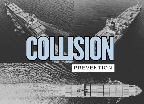
Collision Prevention: Top Strategies to Maximize Safety
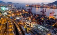
The recent collision in the North Sea has once again highlighted the critical importance of effective collision avoidance strategies in maritime shipping. Ship collisions can lead to severe financial losses, environmental damage, and even fatalities. While basic navigation rules like COLREGs provide a foundation for safe operations, shipowners and fleet operators must go beyond the basics to reduce risks in high-traffic and unpredictable conditions.
Advancements in technology, including AI-driven predictive systems, real-time fleet monitoring, and enhanced situational awareness tools, are transforming how ships navigate safely. This guide outlines the most effective and readily available strategies that shipowners can implement today to improve safety, reduce liability, and minimize the risk of collisions.
📝 View/Print Quick Checklist (PDF)

** We welcome your feedback, suggestions, corrections, and ideas for enhancements. Please email editor @ shipuniverse.com **
🚢 Core Collision Prevention Strategies
Establishing a strong foundation in collision prevention is essential for safe maritime operations. This section covers fundamental strategies that every vessel should implement, including adherence to COLREGs, proper lookout practices, and standardized communication protocols. These measures ensure that all ships operate with a consistent approach to risk mitigation, reducing the likelihood of accidents at sea.
- Strict compliance with COLREGs, including right-of-way rules and safe passing distances.
- Adhering to Traffic Separation Schemes (TSS) to minimize congestion and confusion.
- Maintaining a proper lookout with continuous radar, AIS, and visual monitoring.
- Effective Bridge Resource Management (BRM) to enhance communication and decision-making.
- Clear and effective VHF communication protocols to avoid misunderstandings.
- Regular collision avoidance drills to prepare crews for high-risk scenarios.
- Establish a fleet-wide collision prevention policy emphasizing COLREGs adherence.
- Implement quarterly BRM refresher training for all bridge officers.
- Conduct mandatory collision drills every six months under various simulated conditions.
- Enforce strict VHF communication protocols and ensure all officers are trained in best practices.
- Costs are primarily training-related but require ongoing compliance monitoring.
- No major hardware investment, but simulation-based training may add moderate expenses.
🚢 Navigation & Traffic Awareness Technologies
Effective navigation and real-time traffic awareness are critical for collision avoidance. This section explores advanced technologies such as AIS, ARPA, and marine radar, which enhance a vessel’s ability to detect and respond to potential hazards. By integrating these tools, shipowners can improve situational awareness, minimize navigational errors, and ensure safer passage through congested or high-risk areas.
- Continuous target tracking with automated vessel monitoring.
- Calculates Closest Point of Approach (CPA) and Time to CPA (TCPA) for early collision risk detection.
- Provides early warning alerts for potential hazards.
- Integrates with bridge navigation systems for enhanced situational awareness.
- Ensure ARPA training is mandatory for all bridge officers.
- Standardize fleet-wide CPA and TCPA alert thresholds.
- Regularly test ARPA systems to ensure proper functionality.
- Upgrade to modern ARPA software with enhanced detection algorithms where necessary.
- Requires proper crew training to maximize effectiveness.
- Most commercial vessels are already equipped, but software upgrades may be needed.
- Transmits vessel identity, position, speed, and course to nearby ships and shore stations.
- Enhances situational awareness in congested waterways and adverse weather conditions.
- Enables ship-to-ship and ship-to-shore communication to coordinate movements.
- Reduces reliance on radar alone by providing continuous digital tracking.
- Ensure AIS is properly configured and operational on all fleet vessels.
- Implement routine AIS data checks to verify accuracy and reliability.
- Train bridge crews on using AIS data for safe navigation and collision avoidance.
- Encourage the use of AIS Class A systems for commercial vessels to improve precision.
- Mandatory on most commercial vessels under SOLAS regulations.
- Upgrades to Class A AIS systems may be needed for higher tracking accuracy.
- Combines multiple data sources into a unified control system for enhanced situational awareness.
- Reduces the risk of human error by integrating real-time collision avoidance alerts.
- Improves bridge efficiency by eliminating the need to switch between multiple screens.
- Enhances automation, allowing faster and more accurate responses to collision threats.
- Ensure IBS is fully integrated across all navigation and safety systems on the vessel.
- Train bridge officers to efficiently interpret and act on IBS-generated collision alerts.
- Regularly update IBS software to incorporate the latest safety features.
- Standardize IBS usage across fleet vessels to maintain operational consistency.
- Most modern commercial vessels are equipped with IBS, but older ships may require system upgrades.
- Initial costs can be high, but improved efficiency and safety justify the investment.
- Provides real-time navigation updates to prevent grounding and hazardous deviations.
- Integrates with AIS and radar to improve traffic awareness and collision avoidance.
- Automates route planning, reducing manual chart corrections and improving accuracy.
- Alerts bridge crews of navigational hazards such as restricted areas and underwater obstacles.
- Ensure all vessels in the fleet are equipped with ECDIS and updated digital charts.
- Conduct regular software updates to integrate the latest navigational data.
- Train bridge officers to use ECDIS effectively for real-time decision-making.
- Implement ECDIS redundancy measures, such as backup navigation systems.
- ECDIS is mandatory for many commercial vessels under SOLAS regulations.
- Software and hardware updates may require ongoing investment.
- Enhances visibility in fog, storms, and low-light conditions.
- Provides automatic target tracking to prevent close-quarters situations.
- Integrates with ARPA to predict collision risks based on vessel movements.
- Improves detection of small objects, reducing the risk of collisions with smaller vessels.
- Ensure all fleet vessels have well-maintained radar systems with up-to-date software.
- Train bridge crews to use radar effectively in conjunction with AIS and ARPA.
- Implement radar redundancy by equipping ships with both X-band and S-band radars.
- Conduct regular system tests to verify radar accuracy and performance.
- Most commercial vessels are equipped with radar, but advanced features may require upgrades.
- Regular maintenance is essential to ensure radar reliability.
🚢 Collision Detection & Avoidance Technologies
Beyond basic navigation, advanced detection and avoidance systems provide an additional layer of safety for vessels. This section highlights technologies like LIDAR, infrared sensors, and dynamic positioning systems that help ships detect obstacles in low-visibility conditions and maneuver safely in confined waters. Implementing these technologies enhances a vessel’s ability to proactively avoid collisions and improve overall operational safety.
- Detects small and non-AIS equipped vessels that might not appear on radar.
- Enhances visibility in fog, heavy rain, and night operations.
- Provides 3D mapping of the surrounding environment for more precise navigation.
- Integrates with bridge systems to offer automated alerts for nearby hazards.
- Equip fleet vessels with LIDAR or infrared cameras for enhanced visibility.
- Ensure seamless integration with existing radar and ECDIS systems.
- Train crews to interpret LIDAR and infrared data for effective collision avoidance.
- Conduct regular system tests to maintain accuracy and reliability.
- Infrared cameras are relatively low-cost, but full LIDAR systems require higher investment.
- Integration with bridge systems and training may add to initial implementation costs.
- Maintains vessel position automatically without anchoring.
- Reduces reliance on manual navigation in congested or confined waters.
- Improves safety during docking, offshore operations, and emergency stops.
- Enhances maneuverability in areas where traditional propulsion adjustments are difficult.
- Ensure DPS is properly calibrated and maintained across fleet vessels.
- Train crews to use DPS effectively for station-keeping and precision maneuvering.
- Conduct regular system tests to ensure performance in critical scenarios.
- Integrate DPS data with other navigation systems for improved situational awareness.
- DPS requires installation of specialized thrusters and advanced control systems.
- Training and maintenance are essential for effective operation.
- Enables ships to exchange real-time position, speed, and course data.
- Reduces the risk of miscommunication in high-traffic areas.
- Provides early warnings about vessel course changes or emergency maneuvers.
- Enhances collision avoidance by integrating data with AIS and ECDIS.
- Ensure all vessels in the fleet are equipped with updated AIS transceivers.
- Train bridge crews to interpret and act on shared navigation data.
- Encourage the use of VHF radio alongside AIS for clearer communication in high-traffic areas.
- Implement data-sharing integration with shore-based monitoring centers for added oversight.
- Most commercial vessels are already required to use AIS for data sharing.
- Enhancements may require software updates and crew training.
- Provides real-time position tracking, even in remote open-sea areas.
- Reduces collision risks by suggesting alternate routes in high-traffic zones.
- Optimizes voyage planning based on updated weather patterns and sea conditions.
- Integrates with bridge systems to offer automated collision risk alerts.
- Ensure fleet vessels are equipped with satellite-based navigation systems.
- Integrate satellite data with ECDIS and AIS for a comprehensive navigation strategy.
- Train bridge crews to use weather-adaptive routing tools for safer navigation.
- Regularly update software to improve route optimization and hazard detection.
- Satellite tracking systems require subscription-based services for real-time data access.
- Upfront costs may include new hardware installation and crew training.
- Uses machine learning to predict potential collisions based on real-time vessel data.
- Recommends optimal maneuvers to avoid dangerous encounters.
- Reduces human error by assisting in complex navigation decisions.
- Integrates with ARPA, AIS, and ECDIS for comprehensive risk assessment.
- Equip fleet vessels with AI-assisted navigation and decision-support systems.
- Ensure bridge officers are trained to interpret AI-generated collision predictions.
- Conduct regular system updates to improve AI accuracy and responsiveness.
- Integrate AI-driven recommendations into standard bridge operating procedures.
- AI-based collision avoidance systems require software upgrades and crew training.
- Some vessels may require additional sensor installations for full integration.
- Provides early collision warnings based on real-time navigation data.
- Automatically suggests evasive actions to avoid dangerous situations.
- Integrates with bridge systems to support rapid decision-making.
- Enhances safety by reducing reliance on human reaction time alone.
- Ensure all fleet vessels are equipped with an automated collision alert system.
- Conduct regular testing and calibration to maintain system accuracy.
- Train bridge crews on how to respond to automated collision alerts effectively.
- Integrate alert data with other navigation systems for seamless risk mitigation.
- Many modern vessels already have basic collision alert capabilities, but advanced systems require software upgrades.
- Training is necessary to ensure crews respond effectively to system-generated recommendations.
🚢 Risk Management & Monitoring
Effective risk management and continuous monitoring play a crucial role in collision prevention. This section focuses on fleet-wide remote monitoring centers, real-time ship-to-ship data sharing, and predictive analytics that help shipowners assess potential hazards before they become critical. By leveraging these tools, maritime operators can enhance decision-making, reduce human error, and maintain a proactive approach to vessel safety.
- Monitors vessel movements across an entire fleet in real time.
- Identifies high-risk situations and provides early warnings.
- Allows shore-based teams to assist bridge crews with collision avoidance decisions.
- Enhances situational awareness through integrated data analysis.
- Establish or partner with a remote monitoring center for fleet oversight.
- Ensure vessels are equipped with real-time data transmission capabilities.
- Train shore-based personnel to provide rapid collision avoidance guidance.
- Integrate fleet monitoring data with AI-driven predictive analytics for risk assessment.
- Requires infrastructure for continuous data transmission and monitoring.
- Costs include operational staffing and AI-powered analytics software.
- Provides real-time aerial and underwater surveillance around vessels.
- Improves visibility in restricted areas, such as near port terminals.
- Detects obstacles, icebergs, and other hazards that may not appear on radar.
- Assists in vessel security and emergency response situations.
- Equip vessels with aerial or underwater drones for enhanced monitoring.
- Integrate drone feeds with bridge navigation systems for real-time data analysis.
- Train crews to deploy and interpret drone surveillance data effectively.
- Develop fleet-wide policies for drone-assisted collision avoidance.
- Costs depend on drone type, integration with ship systems, and operator training.
- Regular maintenance and software updates are necessary for optimal performance.
- Minimizes the risk of misinterpretation between ships navigating in congested waters.
- Establishes clear protocols for emergency situations and collision avoidance maneuvers.
- Enhances coordination between ships, port authorities, and monitoring stations.
- Reduces human error by enforcing structured communication formats.
- Implement fleet-wide training on standardized VHF communication protocols.
- Ensure all bridge crews are proficient in Maritime English for clear, unambiguous communication.
- Require VHF confirmation of navigational intentions in high-traffic or restricted areas.
- Integrate VHF best practices into Bridge Resource Management (BRM) training.
- Costs are primarily training-related and require no major hardware investments.
- Standardized VHF communication improves efficiency without adding operational expenses.
- Identifies high-risk maritime areas based on historical collision data.
- Enables shipowners to implement proactive route adjustments.
- Integrates with ECDIS and fleet monitoring systems for real-time risk updates.
- Provides predictive analytics for fleet-wide operational planning.
- Implement collision risk mapping software across fleet operations.
- Use heatmaps to identify and mitigate risk zones in voyage planning.
- Ensure bridge crews are trained to interpret and act on risk alerts.
- Integrate risk mapping with other navigational tools such as AIS and ARPA.
- Requires investment in data analytics software and integration with existing systems.
- Provides long-term cost savings by reducing accident risk and insurance liabilities.
🚢 Route Optimization & Future Collision Prevention Innovations
Optimizing routes and adopting cutting-edge technologies are key to reducing collision risks and improving efficiency. This section explores advanced solutions such as AI-driven voyage planning, digital twin simulations, and augmented reality bridge displays. By integrating these innovations, shipowners can enhance situational awareness, improve navigational accuracy, and ensure safer, smarter operations for the future.
- Provides real-time simulations for training and route optimization.
- Predicts potential collision risks based on live and historical data.
- Enhances fleet management by simulating fuel efficiency and maneuvering strategies.
- Identifies weak points in navigation procedures before real-world incidents occur.
- Integrate digital twin simulation software into fleet training programs.
- Use digital twins for pre-voyage risk assessment and collision scenario testing.
- Ensure bridge officers and fleet operators receive training in simulation-based navigation.
- Regularly update digital twin models with real-time vessel performance data.
- Requires advanced software, data integration, and computing infrastructure.
- High initial costs but provides long-term operational and safety benefits.
- Improves visibility by displaying critical data without obstructing the real-world view.
- Enhances hazard detection by integrating AIS, radar, and collision alerts.
- Reduces the risk of misinterpretation by presenting data in an intuitive visual format.
- Assists bridge officers in making faster, more informed navigation decisions.
- Equip fleet vessels with AR bridge display systems.
- Ensure AR integration with existing navigation and collision avoidance systems.
- Train bridge officers on using AR-enhanced situational awareness tools.
- Conduct real-world testing to optimize AR overlay effectiveness in different conditions.
- Requires specialized AR hardware and software integration.
- High initial cost but offers long-term safety and operational advantages.
- Ensures uniform collision risk calculations across all fleet vessels.
- Reduces variability in how ships interpret and respond to CPA/TCPA data.
- Improves coordination between ships navigating in high-traffic areas.
- Enhances fleet-wide compliance with best collision avoidance practices.
- Develop a fleet-wide ARPA and AIS standardization policy.
- Ensure all vessels use the same threshold values for collision alerts.
- Train bridge crews to interpret ARPA and AIS data consistently.
- Regularly audit vessel compliance with standardized data interpretation rules.
- Requires procedural updates and crew training but no major hardware investment.
- Software standardization may involve minor system updates.
- Reduces human error in route selection and voyage planning.
- Automatically adjusts routes based on traffic, weather, and navigational hazards.
- Integrates with ECDIS, AIS, and collision avoidance systems for optimal decision-making.
- Improves fuel efficiency by selecting routes with the best environmental and traffic conditions.
- Implement fleet-wide adoption of automated voyage planning software.
- Ensure voyage plans are updated dynamically with real-time navigational data.
- Train bridge crews to review and approve AI-generated route recommendations.
- Integrate voyage planning software with risk-mapping and weather-routing tools.
- Software licensing and integration costs vary depending on system complexity.
- Long-term savings in fuel efficiency and risk reduction justify the investment.
Table Summary
| ShipUniverse: Top Collision Avoidance Strategies for Shipowners | |||||
| Strategy | Description | Actionable Steps | Investment | Key Benefits | |
| Collision Avoidance Fundamentals | Ensures crews follow COLREGs, maintain proper lookouts, and use effective communication. | Regular BRM training, fleet-wide collision drills, and strict VHF protocols. | Minimal | Reduces human error, improves response time, ensures fleet-wide safety. | |
| ARPA for Collision Risk Assessment | Uses radar to track vessels, predict movements, and provide early warnings. | Ensure ARPA calibration, set fleet-wide CPA/TCPA thresholds, train crews. | Moderate | Automates vessel tracking, improves decision-making, enhances visibility in poor conditions. | |
| AIS for Real-Time Vessel Tracking | Enables ships to exchange real-time location and movement data. | Ensure all vessels have functional AIS, update software, and train crews. | Minimal to Moderate | Improves traffic awareness, reduces blind spots, enhances navigation in poor visibility. | |
| Integrated Bridge Systems (IBS) | Combines radar, AIS, and ECDIS into a unified interface for better decision-making. | Standardize IBS fleet-wide, train bridge officers, integrate with collision alerts. | Moderate to Significant | Reduces information overload, enhances response time, improves navigation accuracy. | |
| ECDIS for Safer Route Planning | Digital charting system for real-time navigation updates and route optimization. | Update digital charts, train crews, implement backup systems. | Moderate | Automates route planning, reduces human error, integrates real-time traffic data. | |
| Advanced Marine Radar for Early Hazard Detection | Enhances visibility in low-light and poor weather conditions, detecting obstacles early. | Ensure fleet has updated radar systems, train crews on hazard detection, conduct regular system tests. | Moderate to Significant | Improves situational awareness, reduces risk in fog or storms, enables safer navigation. | |
| LIDAR & Infrared Sensors for Low-Visibility Detection | Uses light detection and thermal imaging to identify vessels, icebergs, and floating debris. | Equip fleet with LIDAR or infrared cameras, train crews to interpret data, integrate with radar systems. | Moderate to Significant | Enhances visibility in total darkness, detects non-radar-visible hazards, improves safety. | |
| Dynamic Positioning Systems (DPS) for Safe Navigation | Uses real-time GPS and thruster control to hold position or navigate precisely in confined spaces. | Ensure fleet vessels have DPS where needed, train crews in station-keeping, integrate with bridge systems. | Significant | Improves maneuverability, reduces reliance on anchors, enhances safety in tight areas. | |
| Real-Time Ship-to-Ship Data Sharing | Allows vessels to exchange live navigation data, preventing miscommunication and close calls. | Ensure AIS data is properly transmitted, encourage VHF coordination, integrate with fleet monitoring. | Minimal to Moderate | Reduces confusion in high-traffic areas, improves coordination, enhances safety. | |
| Satellite-Based Collision Avoidance & Weather Routing | Uses satellite data to optimize routes, avoiding high-traffic zones and severe weather. | Equip vessels with satellite navigation, integrate data into route planning, train crews on adaptive navigation. | Moderate to Significant | Improves route efficiency, minimizes collision risks, enhances weather adaptability. | |
| AI-Powered Collision Prediction & Risk Avoidance | Uses AI to analyze vessel movements, predict potential collisions, and recommend safe maneuvers. | Equip fleet with AI-assisted navigation, integrate with ARPA/AIS, train crews on AI alerts. | Moderate to Significant | Reduces human error, enables faster decision-making, improves long-range collision prediction. | |
| Automated Emergency Collision Alerts & Decision Support | Real-time collision alerts with automated maneuvering recommendations to avoid close calls. | Install automated alert systems, ensure integration with ECDIS/radar, train crews to act on alerts. | Moderate | Provides instant risk alerts, improves response time, enhances bridge crew efficiency. | |
| Fleet-Wide Remote Monitoring Centers | Shore-based centers monitor fleet movements, provide risk alerts, and assist in navigation decisions. | Establish monitoring centers, equip vessels with real-time data transmission, train shore-based teams. | Significant | Reduces reliance on onboard crew alone, enhances risk oversight, improves fleet-wide safety. | |
| Maritime Drones for Surveillance & Blind Spot Monitoring | Aerial and underwater drones monitor blind spots, detect obstacles, and enhance vessel security. | Equip ships with surveillance drones, integrate live feeds with bridge systems, train crews on deployment. | Moderate to Significant | Reduces collision risks in restricted areas, improves blind spot awareness, aids in emergency response. | |
| Standardized VHF Communication to Reduce Misunderstandings | Enforces clear and standardized VHF protocols to improve communication between vessels. | Implement standardized VHF procedures, train crews, require confirmation of navigation intentions. | Minimal | Reduces miscommunication, enhances coordination, prevents close-call situations. | |
| Collision Risk Mapping & Heatmaps | Uses historical data and AI to identify high-risk areas and optimize routes accordingly. | Implement collision risk mapping software, integrate with ECDIS, train crews on risk zones. | Moderate | Improves route planning, reduces accident-prone navigation, enhances safety awareness. | |
| Digital Twin Simulations for Collision Avoidance | Creates virtual ship models to test collision scenarios and train crews on real-world risk mitigation. | Adopt digital twin software, integrate live ship data, conduct simulation-based crew training. | Significant | Enhances training, prevents real-world mistakes, improves fleet-wide risk assessment. | |
| Augmented Reality (AR) Bridge Displays | Overlays real-time navigational data on transparent screens for better situational awareness. | Equip vessels with AR bridge displays, integrate with AIS/radar, train crews on AR visualization. | Significant | Improves navigation clarity, reduces reliance on multiple screens, enhances decision-making. | |
| Standardized ARPA & AIS Data Interpretation | Ensures that all vessels follow uniform thresholds for collision avoidance alerts and responses. | Develop fleet-wide standards, calibrate ARPA/AIS systems, train crews on uniform response protocols. | Minimal to Moderate | Eliminates inconsistencies, improves reaction times, enhances fleet-wide safety. | |
| Automated Voyage Planning for Smarter Navigation | AI-driven route planning that adjusts dynamically based on traffic, weather, and risk factors. | Implement AI voyage planning, integrate with risk mapping, train crews on adaptive routing. | Moderate to Significant | Reduces human error, optimizes fuel efficiency, minimizes high-risk route exposure. | |

Do you have a Maritime Product or Service that may be of interest to Shipowners? Tell us about it here!
Do you have feedback or insights? Please reach out to editor @ shipuniverse.com